LUNRI
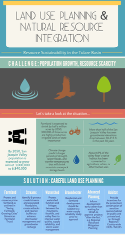 Click image to view larger format.
The Land Use and Natural Resource Integration (LUNRI) program is designed to provide county planners and decision-makers with guidelines to make sustainable, long-term land use choices that strike a balance between growth and protecting the natural resources upon which we all depend. The focus is on natural resource conservation and restoration in the non-urban areas of the Tulare Basin in Fresno, Tulare, Kings, and Kern Counties.
Through the LUNRI effort, the Tulare Basin Wildlife Partners (TBWP) has developed seven land use recommendations and guidelines, outlined below and in our guide. These recommendations are based on an analysis of the best available documents related to farmland conservation, water resource management, and habitat conservation/restoration, as well as discussions with members of the San Joaquin Valley Greenprint, Tulare Basin Integrated Regional Water Management (IRWM) groups, water district managers, federal/state agency staff, non-profit organizations, and field experts. These recommendations work in concert with several other regional efforts—for example, the SJV Greenprint, IRWM, and the Tulare Basin Watershed Connections Working Group—with a goal to conserve and replenish natural resources in rural areas and support smart growth in urban areas.
Driving the identification of these collaborative recommendations is the fact that every land use decision impacts the “system.” The system is the watershed and all of its resources (land, air, water, biota) that may be used, transferred, or impacted by various land use decisions. LUNRI advocates that every decision allocating natural resources in and around our communities should be analyzed from the standpoint of how those choices impact the overall system. When Valley planners, decision-makers, and the general public can look at land use planning from this whole system perspective, we will be on our way to a smart growth path that finds balance between urban needs and rural resources.
READ THE LUNRI GUIDEBOOK, click here. The recommendations and next steps found in the guidebook are also outlined below. Special thanks to the Fresno Regional Foundation for funding this work.
LUNRI Recommendations/Links |
Links to Other Resources: |
Recommendations
1. Protect and conserve prime farmland
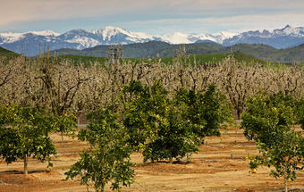 Photo by John Greening
Utilize the American Farmland Trust’s recommendations in “Saving Farmland, Growing Cities – A Framework for Implementing Effective Farmland Conservation Policies in the San Joaquin Valley.” AFT identified six objectives to address agricultural conservation challenges:
Benefits:
- Avoid development of high-quality farmland
- Minimize farmland loss with more efficient development
- Ensure stability at the urban edge
- Minimize rural residential development
- Mitigate the loss of farmland with conservation easements
- Encourage a favorable agricultural business climate
Benefits:
- Regional economic benefits – agriculture drives much of the region’s economy
- National food security - Fresno, Tulare, Kern, and Kings Counties are among the most productive agricultural counties in the nation (Fresno and Tulare are number 1 and 2)
- Opportunity for multiple-benefit resource protection, e.g. groundwater recharge
2. Protect ecologically sensitive areas that provide groundwater recharge, storm water management, habitat, and recreation.
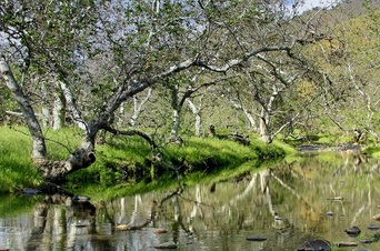 Photo by John Greening
Identify and protect creeks/streams and the associated floodplains through the creation of setbacks and riparian buffers.
Benefits:
Identify and protect vernal pool complexes
Benefits:
Benefits:
- Increase groundwater – setbacks help recharge groundwater in years of moderate to high rainfall
- Riparian vegetation – provides shade, cooler water, reduces evaporation
- Improve water quality – natural processes filter pollutants such as sediment, pesticides and other contaminants
- Mitigate flood damage – well-established riparian vegetation reduces velocity of flood flows and slows storm water runoff
- Create habitat – one mile of 50 foot buffer on both sides of a stream protects 12 acres of habitat
- Nutrient uptake – trees absorb nitrates and phosphates
- Energy conservation – reduces thermal loading of streams, erosion, pollution, flooding
- Stabilize stream banks – root systems of riparian trees reduce erosion
- Reduce atmospheric pollution – riparian buffers help trap and filter air pollution
- Improve quality of life – provide recreation and educational opportunities
Identify and protect vernal pool complexes
Benefits:
- Provide unique habitat for amphibians and invertebrates
- Enhance water quality with discharges into natural wetlands
- Enhance watershed function and storm water management
- Provide groundwater recharge
3. Protect watershed function and linkages between the mountains, foothills and valley floor
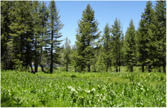 Photo by Niki Woodard
Protect water quality, water supply reliability, and storm water management. Develop inter-regional projects with multiple stakeholders (public and private), e.g. the Southern Sierra IRWM, Kings Basin Water Authority, Fresno and Tulare Counties, and landowners to connect upper and lower watershed function.
Benefits:
Benefits:
- Improve upstream water storage and storm water retention in meadows and streams
- Improve water supply reliability
- Increase erosion control and reduced sedimentation downstream
- Provide floodwater attenuation
- Improve overall water supply reliability and water quality
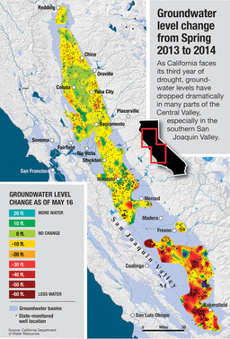
4. Protect local groundwater
 David Pierce/KQED. Click image to read KQED article.
Disincentivize development of previously unfarmed or “marginal” farmland (classified through land classification and/or other studies) where there are declining groundwater resources.
Establish precedent that both residential and farmland development should be subject to a water supply reliability study prior to approval.
Benefits
Establish precedent that both residential and farmland development should be subject to a water supply reliability study prior to approval.
Benefits
- Meet new state requirements with local management of groundwater resources, avoid state control of regional groundwater resources
- Reduce conflicts between users
- Long-term sustainability for communities, growers, and others dependent upon groundwater
- Conservation of wildlife species that depend upon these uncropped lands
5. Engage in regional resource management and planning efforts
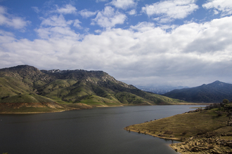 Photo by John Greening
Integrated Regional Water Management: A collaborative effort to identify and implement water management solutions on a regional scale. IRWM is a philosophy and practice of coordinating the management of water and related resources for the purpose of maximizing economic and societal benefits while maintaining the sustainability of vital ecosystems.
Benefits:
San Joaquin Valley Greenprint: The SJV Greenprint is a voluntary, stakeholder-driven project that provides agricultural, water, and environmental leaders with improved planning data and fosters regional collaboration on strategies that promote resource sustainability while enhancing economic prosperity. It focuses on the challenges and opportunities in non-urban land use planning, and how those rural decisions shape the region’s economy and environment.
Benefits:
Benefits:
- Improve regional and statewide water and flood management
- Increase regional self-reliance
- Reduce conflict
- Manage water to concurrently achieve social, environmental and economic objectives
San Joaquin Valley Greenprint: The SJV Greenprint is a voluntary, stakeholder-driven project that provides agricultural, water, and environmental leaders with improved planning data and fosters regional collaboration on strategies that promote resource sustainability while enhancing economic prosperity. It focuses on the challenges and opportunities in non-urban land use planning, and how those rural decisions shape the region’s economy and environment.
Benefits:
- Identify regional conservation and growth strategies
- Better prepare for development impacts and mitigate according to a regional plan
- Participate in regional planning efforts that prioritize resource sustainability
- Save planning staff time and resources by accessing a comprehensive database of regional (San Joaquin Valley) maps
6. Provide incentives for the protection/conservation of sensitive species habitat on public and private land
 Photo by Steve Laymon
Incentivize creation of habitat on fallowed lands without penalties. Rather than disking, encourage a natural “cover crop” that can provide habitat. Allow the land back into production without penalty under the federal or state law. Other land uses such as grazing should also be considered.
Benefits
Develop Regional/County-wide Habitat Conservation Planning/Natural Communities Conservation Plans that can streamline development and land use plans. Identify areas that will be set aside not only for threatened and endangered species (as required for granting an incidental take permit under HCP/NCCP), but for watershed benefits such as groundwater recharge, storm water management, recreation and water quality.
Benefits
Benefits
- Reduce costs
- Decrease greenhouse gas emissions
- Provide refugia for wildlife during drought-stricken times
- Provide assurances that the land can be put back into production without penalties
Develop Regional/County-wide Habitat Conservation Planning/Natural Communities Conservation Plans that can streamline development and land use plans. Identify areas that will be set aside not only for threatened and endangered species (as required for granting an incidental take permit under HCP/NCCP), but for watershed benefits such as groundwater recharge, storm water management, recreation and water quality.
Benefits
- Provide incidental take for otherwise lawful activities under the federal Endangered Species Act, rather than engage time consuming individual permits
- Meet compensatory mitigation under the federal and state endangered species acts
- Help meet regional endangered species conservation and recovery goals
- Increase groundwater recharge capacity through land conservation
- Assist with regional resource management and planning efforts (see 6)
7. Develop a tool to inform development through early engagement rather than wait for a CEQA document that approves projects “after-the-fact”
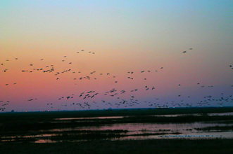 Photo by Niki Woodard
Regional Advance Mitigation Planning RAMP) – RAMP is a regional approach to compensatory mitigation planning and works by pooling mitigation needs from multiple projects to acquire fewer, but spatially larger, parcels for project impact compensation. By incorporating regional mitigation planning in the early stages of project development, rather than later, parcels can be acquired before land prices increase, and costly delays may also be avoided.
Habitat Conservation Planning/Natural Communities Conservation Plans (see 5)
Regional 404 permits (Clean Water Act)
Benefits:
Habitat Conservation Planning/Natural Communities Conservation Plans (see 5)
Regional 404 permits (Clean Water Act)
Benefits:
- Save time and money by eliminating redundancy associated with regulatory processes
- Improve ecological outcomes
- Preserve ecological integrity of the land by acquiring less fragmented parcels; also reduces costs
- Contribute to the implementation of a long-term regional Greenprint; develop conservation priorities
- Build support from a large array of stakeholders
Next Steps
Data collection and management
Improved data collection, management, and sharing is critical to the implementation of these recommendations. Through efforts initiated by the Counties, IRWMs, SJV Greenprint, and others, the region is enhancing its data options. Publically-available interactive mapping tools facilitate the development of map composites (i.e. those that the TBWP has been developing with Greenprint data), which help identify multi-benefit natural resource conservation/restoration project opportunities.
Build consensus
Conducting outreach and education is a key strategy for building consensus.
The TBWP will continue to facilitate collaboration among IRWMs, the Watershed Connections Working, SJV Greenprint, federal/state agencies, County planning departments, California Partnership for the San Joaquin Valley, American Farmland Trust, landowners, and the general public.
Identify pilot projects
The TBWP will work with its partners to identify pilot projects in Tulare Basin counties – Fresno, Kings, Tulare, and Kern – that can test these recommendations and set an example for best management plans (BMPs) that can be replicated.
Greenprint Mapping
These recommendations can be further developed with use of data provided by the San Joaquin Valley Greenprint. As a collection of maps showing the state of natural resources in the San Joaquin Valley, planners can make land use decisions that provide multiple benefit solutions to vexing natural resources challenges. The following three maps show three composites of overlapping natural resource benefit scenarios.
FMMP 2010, Central Valley Corridors, California Protected Areas Database (2013B), FEMA: Flood Hazard Areas (FIRM), Ground Water Recharge Areas, Major Roads, City Limits of the San Joaquin Valley.
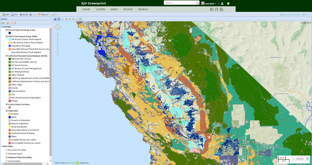
CLICK ON MAP TO VIEW FULLSCREEN.
Explanation of layers:
Central Valley Corridors -- This dataset represents a potential conservation network for the Central Valley ecoregion. The analyses used a focal species-based approach to delineate core and corridor areas. Corridors were derived using species-specific analyses conducted with the least cost corridor function in ArcGIS and link adjacent cores.
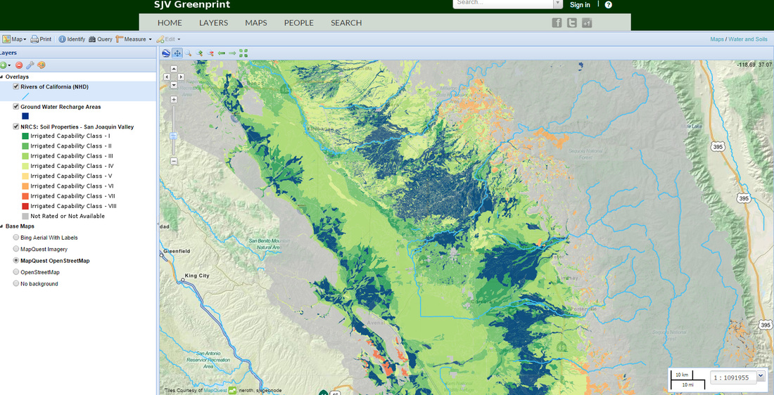
Ground Water Recharge Areas -- The San Joaquin Valley is a water limited region. Surface water availability can vary widely on an annual basis making ground water an essential component of the region’s water supply. Implicit in this is the need to protect areas that contribute to recharging groundwater supplies. This dataset was derived by the California Water Institute from the NRCS SSURGO and STATSGO datasets based primarily on drainage class. Additional criteria based on slope and Storie Index were also used for some soil categories. This dataset is has only a single category indicating that the area is a likely recharge zone.
FMMP 2010 -- Farmland Mapping and Monitoring Program (FMMP) 2010. Data provided by the Division of Land Resource Protection, California Department of Conservation. http://conservation.ca.gov/dlrp/fmmp/Pages/Index.aspx. [Note: TBWP simplified this layer by only identifying non-prime/important farmlands because this map is focusing on land use on non-ag lands.]
California Protected Areas Database (2013B) -- The California Protected Areas Database contains data about lands that are owned outright (“in fee”) and protected for open space purposes by over 900 public agencies or non-profit organizations. (A separate database is being developed for those lands protected through easements and related less-than-fee mechanisms). CPAD lands range from the smallest urban parks all the way to the largest wilderness areas – all told, CPAD inventories just over 49 million acres in 13,500 “parks” (SUPER UNITS). CPAD is published by GreenInfo Network (www.greeninfo.org). From late 2012 to 2014, updates will be published approximately every six months, due to funding available from the California Strategic Growth Council, through the U.S.G.S. Gap Analysis Program. http://www.calands.org/ [Note: TBWP simplified this view by making all federal lands green, state lands brown, municipal lands purple, and private/NGO conservation lands pink. Reducing visible colors helps make distinct layers more visible.]
FEMA Flood Hazards Areas (FIRM) -- The National Flood Hazard Layer (NFHL) data incorporates all Flood Insurance Rate Map (FIRM) databases published by the Federal Emergency Management Agency (FEMA), and any Letters Of Map Revision (LOMRs) that have been issued against those databases since their publication date. http://sjvmaps.ice.ucdavis.edu/layers/geonode:fema_fld_haz_areas
Central Valley Core Habitat (Huber), Groundwater Recharge Basins, Retired Farmland, Central Valley Corridors, and SSP Regional Conservation Design.
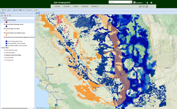
CLICK ON MAP TO VIEW FULLSCREEN.
Explanation of layers:
Southern Sierra Partnership's Regional Conservation Design -- Regional Conservation Design generated by the Southern Sierra Partnership as part of the report: Climate-adapted Conservation Plan for the Southern Sierra Nevada and Tehachapi Mountains. Purpose: To prioritize conservation strategy implementation in the region, focusing on intact areas that provide multiple benefits in terms of connectivity, plant and animal habitat, aquatic resources and factors that promote climate change adaptation. The full description of inputs and approach is available through the plan mentioned in the abstract available at: http://databasin.org/datasets/1ee52eef6c7a42668d637acef352ded2
Central Valley Core Habitat Areas -- Created by Dr. Patrick Huber as part of his dissertation as a definition for core habitat areas. This was defined through an integrated consultation process with land use managers and conservation organizations.
Retired Farmlands -- Retired Farmlands are areas that are no longer suitable for farming. This is generally a result of poor soil quality, which can be attributed to high salinity or drainage problems. Purpose: This layer allows for a clear depiction of areas that cannot sustain crops and have little to no agricultural value. Supplemental Information: This layer was provided by the CSU Stanislaus-Endangered Species Recovery Program.
Groundwater recharge, rivers, and NRCS soil properties
CLICK ON MAP TO VIEW TO VIEW FULLSCREEN.
CLICK ON MAP TO VIEW TO VIEW FULLSCREEN.


