"One Watershed" Series
|
#1 Getting to Know the Tulare Lake Watershed
Watersheds are distinct places, defined by meaningful boundaries that, unbeknownst to many of us, have a significant impact on, well, just about everything.
Water is the lifeblood of our society, especially in the arid Central Valley, where fertile soils have given rise to an agricultural economy that helps feed the world. As the region’s population grows, climate changes, and groundwater supplies shrink, it is imperative that we collectively manage our watershed in the smartest way possible. The first step to smart management is to expand our collective knowledge of the watershed in which we live. Every watershed is unique, and the Tulare Lake watershed – also called the Tulare Lake Basin – is no exception. Our watershed and all of the stories about its particular hydrology, ecology, geology, history, culture, and economy is something to know, take pride in, and take care of. 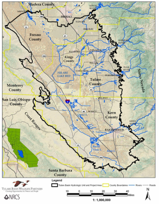
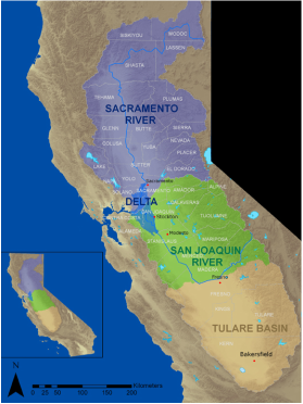
The Tulare Lake Watershed
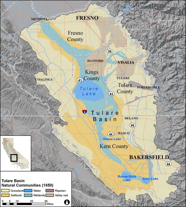
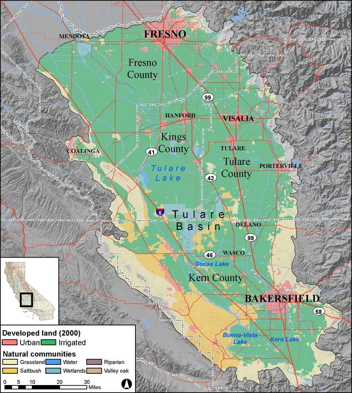
A watershed is the area of land where all of the water that falls into it naturally travels to the same destination. The Tulare Lake watershed gets its name from the former lake that once received water flows from the entire region, including snowmelt from the upper Sierra Nevada. The Tulare Lake was once the largest freshwater lake and wetland complex west of the Mississippi River, spanning up to 790 square miles (in 1862), or four times the surface area of Lake Tahoe (192 square miles). The watershed stretches up to approximately 134 miles east to west – from the Sierra Nevada to the Coast Ranges – and 163 miles north to south – from the San Joaquin River to the Tehachapi Range. In total, it covers about 17,000 square miles. The Tulare Lake watershed is outstanding in a number of ways. The upper watershed boasts some of the nation’s most spectacular protected areas, including Sequoia and Kings Canyon National Parks and Sierra and Sequoia National Forests. It is home to the tallest peaks in the continental United States, including Mt. Whitney, which tops the list at 14,505 feet. Water that falls in the upper watershed feeds scenic and ecologically diverse mountain meadows as well as the world’s largest trees, the giant sequoias, which draw millions of tourists from near and far to revel in their majesty. That water also forms the headwaters of the mighty Kings, Kaweah, Tule, and Kern Rivers, as well as other mountain streams and creeks that flow to the valley floor, historically converging in the Tulare Lake. That same water also quenches the thirst of a growing population of diverse communities and the most productive agricultural lands in the nation. Fresno, Tulare, Kings, and Kern Counties are consistently among the nation’s top producers of a variety of nuts, fruits, vegetables, and dairy and animal products. The region’s agricultural productivity and urban growth, however, has come at a cost to the native ecology. The valley, or lowland, portion of the Tulare Lake watershed has lost 90 - 95% of its native habitat, the highest percentage of native habitat loss in California. The lower watershed also has the smallest proportion of protected natural land and one of the smallest percentages of public recreational land per capita of any region in California. Nonetheless, Tulare Lake Basin lowlands feature a diversity of habitats: freshwater lakes and wetlands, desert scrub, alkali grassland, riparian forests, oak woodlands, and vernal pools. The region contains some of the greatest plant and animal diversity found anywhere in California. Many Tulare Lake watershed species, however, are endangered, threatened, or sensitive, including 42 birds, 13 mammals, and 17 invertebrates, amphibians, and reptiles. Several of these species are unique to the Tulare Basin.
The hydrology of the Tulare Basin is a complicated story, as it is for most California watersheds. Water enters the region through a variety of sources – direct precipitation, runoff from mountain snowmelt, imported water through the State Water Project and federal Central Valley Project, and groundwater pumped from underground aquifers. The amount of water from each of these sources varies greatly depending upon annual precipitation. In dry years such as the last few, groundwater is pumped more heavily to compensate for the shortage of surface water flows. This unregulated practice has shrunk reserves to dangerously low levels that are expensive to maintain, caused the land to collapse on itself (land subsidence), and has led to contamination of precious drinking water sources. Coordinated whole watershed management, however, is a promising path toward improving the balance between water supply and demand.
Lastly, the human history of the Tulare Lake watershed is also a fascinating story. The Yokuts, including Tulare Lake’s Tache Yokuts, were the primary Native American tribes living in the region. The Yokuts population was at least as high as 40,000.[i] In the 1870’s, European settlers diverted the rivers and streams that once drained into the Tulare Lake for agriculture. These diversions, and periods of drought, gradually diminished the size of the lake, which devastated the once abundant populations of fish, turtles, and other lake-dwelling species along with lake-visiting species like migratory water birds. By 1898, the lake dried up completely, only to partially fill up during times of flood. Some say, today, that restoring the lakebed’s ability to naturally hold flood flows would benefit water management in the area. But many farmers whose livelihood is rooted in the lakebed are opposed. Whatever the solution, it is time that we come together to explore creative, environmentally sustainable, economically sound, whole watershed solutions to our complex supply and demand challenges, especially in light of a changing climate. Each person living in the watershed should take owndership of these challenges, and the opportunities. And it starts with knowledge. Onward! This article is the first in a series called “One Watershed Series,” which aims to raise awareness about the Tulare Lake Basin watershed, its issues, and its opportunities. Future articles will dig deeper into the stories presented above, as well as watershed issues, challenges, and management strategies. Please email us if you have specific requests or suggestions for our series. -- i] Austin, J.T. 2012. Floods and Droughts in the Tulare Lake Basin. Sequoia Natural History Association, Three Rivers, California, pg. 50. |
Mission: To raise awareness about the Tulare Lake Watershed and its unique attributes, challenges, and opportunities. From the snowy peaks to the valley floor, we are one watershed.
This project is made possible by grant funding from the Fresno Regional Foundation.

This project is part of the Tulare Basin Watershed Initiative.

HELPFUL LINKS:
Other articles
|
Natural Beauty in the Tulare Lake Watershed
It can sometimes seem that the Central Valley, especially the southern half, can be dismissed and disrespected as the undesirable part of California. This attitude comes from both inside and outside the Valley. Despite some unflattering statistics about the region – i.e. about air quality, health, and educational achievement – there is much to experience and celebrate about the region, our watershed.
Rob Hansen, biologist at the College of the Sequoias reminds us, “We tend to treat a place in ways that reflect how we think about the place.” To create a more positive and productive attitude toward this place, he advises us to redirect any negative or ambivalent energy toward the abundant treasures and opportunities that exist in this unique Tulare Basin watershed, from top to bottom. What better way to redirect that to explore?
Here is a list of several Tulare Basin valley destinations for which we should all make a point of visiting:
|
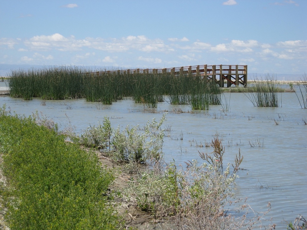
Atwell Island Tache Wetlands bird observation deck. © Johanna Lombard
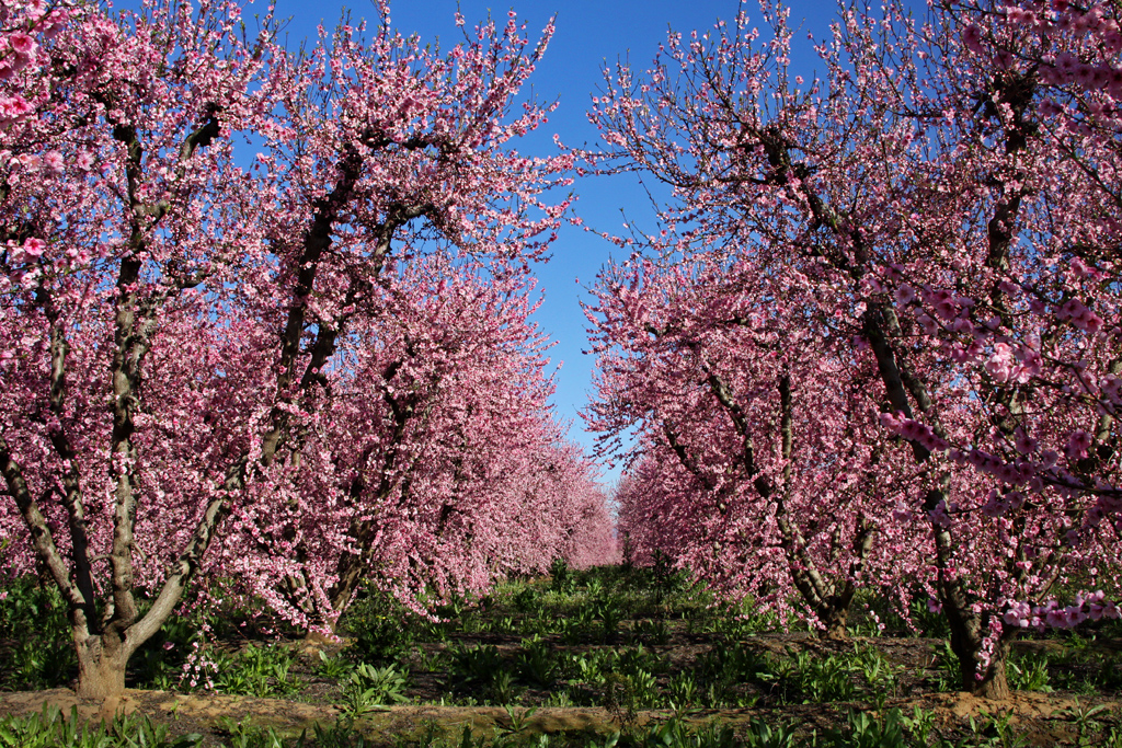
Peach blossoms, Tulare County. © John Greening
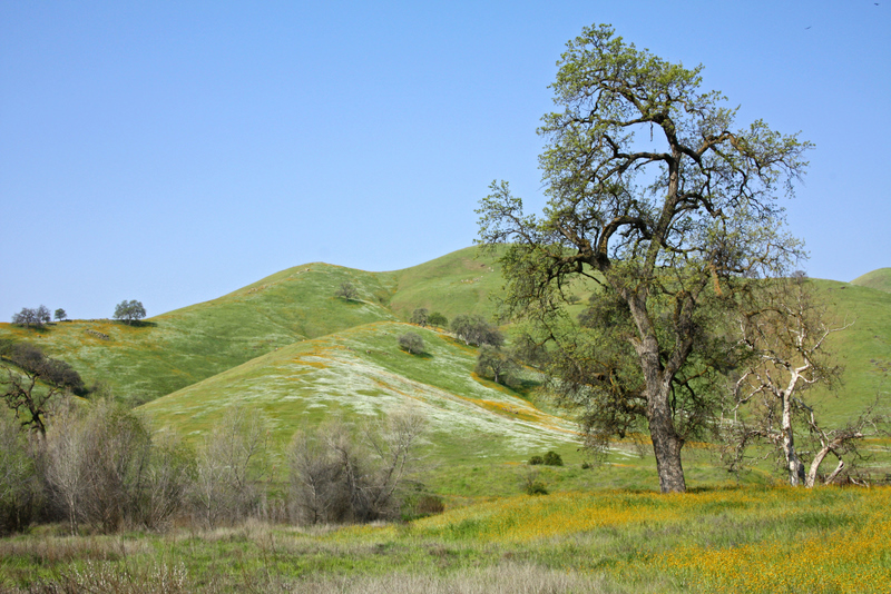
Dry Creek Preserve © John Greening
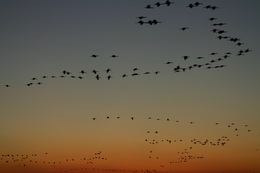
Sandhill cranes at Pixley National Wildlife Refuge © Niki Woodard
|
See www.tularecountytreasures.org for more information on the treasures of Tulare County.
